Tour of the Eastern Cape
Rural Education Development
Learnthings Africa
Rural South Africa
30 January - 4 February 2010
Background
For nearly a month I traveled more than 7000 km through the Eastern Cape of South Africa (including the area previously known as the Transkei) to install Learnthings and Microsoft software content at poor rural schools on behalf of Learnthings Africa.
In this post, I cover Port Alfred, an upmarket holiday town, where I lodged during my weekend off; King Willams Town; Fort Beaufort and Toise.
This was the last 4 days of my entire tour of the Eastern Cape.
 |
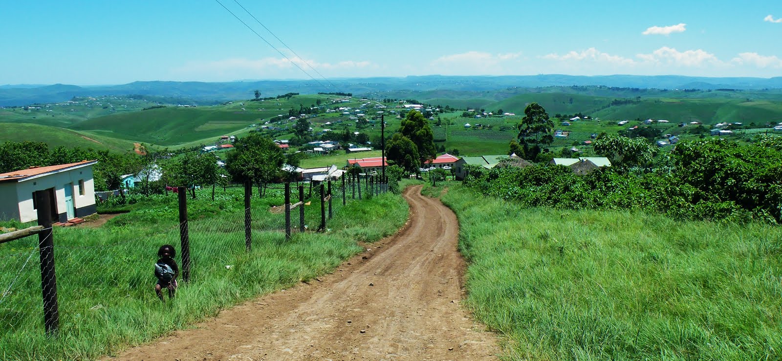
| Nature scenery, near King Williams Town, Eastern Cape |
About the Eastern Cape
The Eastern Cape is a province of South Africa. Its capital is Bhisho, but its two largest cities are Port Elizabeth and East London.
It was formed in 1994 out of the Xhosa homelands of Transkei and Ciskei, together with the eastern portion of the Cape Province.
Landing place and home of the 1820 settlers, the central and eastern part of the province is the traditional home of the Xhosa people.
This region is the birthplace of many prominent South African politicians, such as Nelson Mandela, Oliver Tambo, Walter Sisulu, Govan Mbeki, Raymond Mhlaba, Chris Hani, Thabo Mbeki, Steve Biko, Bantu Holomisa and Charles Coghlan (Wikipedia).
 |
| Port Alfred marina - Eastern Cape |
Port Alfred
Saturday & Sunday 30 - 31 January 2010
I arranged with Susan to book a room in Port Alfred instead of King Williams town and she booked a room at the Ferndale B & B in 13 Ferndale Road, where I spent the weekend.
Thus far the best place I have stayed on my trip, the Ferndale B & B was a great choice.
The owner Kevin made me feel welcome and they were very hospitable. He even lent me his bicycle to explore Port Alfred and take pictures. I had great conversations with him and his wife. I also caught up on much-needed sleep.
About Port Alfred
Port Alfred is a small town in the Eastern Cape province of South Africa. It has a population of just under 26,000 and is situated on the eastern seaboard of the country at the mouth of the Kowie River, almost exactly halfway between the larger cities of Port Elizabeth and East London.
It was established in the early 1820s by British settlers who were moved into the area by Lord Charles Somerset as a buffer between the Cape Colony and the Xhosa people.
Originally it was two separate towns (settlers arriving on the west bank in 1820 named their settlement Port Kowie, and those arriving on the east bank named theirs Port Frances.
When Queen Victoria’s son Prince Alfred visited, the place in 1860, the name was changed (Wikipedia).
It was established in the early 1820s by British settlers who were moved into the area by Lord Charles Somerset as a buffer between the Cape Colony and the Xhosa people.
Originally it was two separate towns (settlers arriving on the west bank in 1820 named their settlement Port Kowie, and those arriving on the east bank named theirs Port Frances.
When Queen Victoria’s son Prince Alfred visited, the place in 1860, the name was changed (Wikipedia).
 |
| Port Alfred marina - Eastern Cape |
 |
| Port Alfred marina - Eastern Cape |
 |
| Port Alfred marina - Eastern Cape |
 |
| Port Alfred marina - Eastern Cape |
 |
| Marina - the photo was taken from the Nico Malan bridge, in Port Alfred |
 |
| Nico Malan bridge at night - Port Alfred |
 |
| Nico Malan bridge - Port Alfred |
 |
| Port Alfred marina - Eastern Cape |
 |
| Nico Malan bridge at night - Port Alfred |
Monday 1 February 2010
After I checked out of the Ferndale B & B in Port Alfred, I drove the 30 km on the R 63 to Nompucuko School near Kent on Sea. I arrived at around 8:30 am and met the principal who was on his way out, but he asked Mr. Yankwa to assist me. I then installed both primary and secondary content on 30 PCs.
I left for Grahamstown about 60 km from Kent on Sea and arrived at the district center to make further installations.
I then made the 120 km drive to King Williams town where I booked in at the Amatola Mountain View B & B in 14 Gerhardi Street.
 |
| The scenery on the road between Grahamstown and King Williams Town, Eastern Cape |
 |
| The scenery on the road between Grahamstown and King Williams Town, Eastern Cape |
 |
| The scenery on the road between Grahamstown and King Williams Town, Eastern Cape |
Fort Beaufort
Tuesday 2 February 2010
After Breakfast and my telephone conversation with Mrs. Bokweni of the Fort Beaufort district center I drove the 45 km to Ntabenkonyana High School near Middledrift. I was met by the deputy principal and was shown to the lab.
Mrs. Bokweni and I then managed to install secondary content on 30 lab PCs. The principal later came to see me and I gave him a demonstration on how to use the software. He was really excited about it and he seems to really appreciate any resources especially e-learning. His lab is in an excellent condition and he takes a personal interest in it.
Nobody from the district again could assist me but said they were waiting for me at the District center to come and install content there. I arrived at the center at after driving another 40 km to Fort Beaufort on the R 63.
Mr. Vijayakurup from the Center gave me directions and welcomed me personally at the center. He even bought me lunch and I had renewed strength to install. I installed primary and secondary content on 31.
The IT specialist Mr. Monga repaired some PCs so I could install on them. I finished around 5 pm and then drove the 80 km back to King Williams Town.
Mrs. Bokweni and I then managed to install secondary content on 30 lab PCs. The principal later came to see me and I gave him a demonstration on how to use the software. He was really excited about it and he seems to really appreciate any resources especially e-learning. His lab is in an excellent condition and he takes a personal interest in it.
Nobody from the district again could assist me but said they were waiting for me at the District center to come and install content there. I arrived at the center at after driving another 40 km to Fort Beaufort on the R 63.
Mr. Vijayakurup from the Center gave me directions and welcomed me personally at the center. He even bought me lunch and I had renewed strength to install. I installed primary and secondary content on 31.
The IT specialist Mr. Monga repaired some PCs so I could install on them. I finished around 5 pm and then drove the 80 km back to King Williams Town.
About Fort Beaufort
Fort Beaufort is a town in Eastern Cape Province and has a population of about 26 000 (2011).
The town was established in 1837 and became a municipality in 1883. The town lies at the confluence of the Kat River and Brak River between the Keiskamma and Great Fish Rivers.
It serves as a mini-dormitory' for academic staff and students of Fort Hare University, based in the nearby town of Alice, and is also close to sulfur springs (Wikipedia).
The town was established in 1837 and became a municipality in 1883. The town lies at the confluence of the Kat River and Brak River between the Keiskamma and Great Fish Rivers.
It serves as a mini-dormitory' for academic staff and students of Fort Hare University, based in the nearby town of Alice, and is also close to sulfur springs (Wikipedia).
 |
| Fort Beaufort, Eastern Cape |
 |
| Fort Beaufort, Eastern Cape |
 |
| Near Alice - Eastern Cape |
Nature scenery - near King Williams Town
 |
| Nature scenery, near King Williams Town, Eastern Cape |
 |
| Nature scenery, near King Williams Town, Eastern Cape |
 |
| Nature scenery, near King Williams Town, Eastern Cape |
 |
| Near King Williams Town |
Wednesday 3 February 2010
After breakfast, I contacted the KWT District contact, Mrs. Masabalala who asked me to meet her at the District office in King Williams Town. I me
We decided to start with Isihoboti Combined School, located in Toise location, approximately 25 km from Stutterheim. We arrived around 09:30 am and met with the principal, Mr. Gayoyo.
After I explained what we were about to do, he gave us access to the lab. I installed both primary and secondary content on 26 PCs. I gave the principal and Mrs. Masabalala a demonstration on how to use the software and they seemed very excited about the possibilities. The lab is in an excellent condition and everybody seemed committed to e-learning.
Mrs. Masabalala and I left around 13:30 pm and drove the 60 km back to KWT. We arrived at 14:30 at the E-learning Resource Center located at the De Vos Malan High School in KWT. They were busy with a workshop and we could only gain access to the PC lab at 3 pm. We installed both primary and secondary content on all 32 available PCs.
I also showed some district officials how the software works and they seemed excited about it.
I managed to, with the help of Mrs. Masabalala to finish around 6 pm and fortunately only had to drive, according to my GPS, 400 m to my B&B.
We decided to start with Isihoboti Combined School, located in Toise location, approximately 25 km from Stutterheim. We arrived around 09:30 am and met with the principal, Mr. Gayoyo.
After I explained what we were about to do, he gave us access to the lab. I installed both primary and secondary content on 26 PCs. I gave the principal and Mrs. Masabalala a demonstration on how to use the software and they seemed very excited about the possibilities. The lab is in an excellent condition and everybody seemed committed to e-learning.
Mrs. Masabalala and I left around 13:30 pm and drove the 60 km back to KWT. We arrived at 14:30 at the E-learning Resource Center located at the De Vos Malan High School in KWT. They were busy with a workshop and we could only gain access to the PC lab at 3 pm. We installed both primary and secondary content on all 32 available PCs.
I also showed some district officials how the software works and they seemed excited about it.
I managed to, with the help of Mrs. Masabalala to finish around 6 pm and fortunately only had to drive, according to my GPS, 400 m to my B&B.
 |
| Toise, near Stutterheim |
 |
| Mrs. Masabalala, my guide from the Eastern Cape Department of Education at Isihoboti Combined school - Toise, near Stutterheim |
 |
| Isihoboti Combined school - Toise, near Stutterheim |
 |
| Toise, near Stutterheim |
 |
| Toise, near Stutterheim |
 |
| Toise, near Stutterheim |
 |
| Toise, near Stutterheim |
 |
| Toise, near Stutterheim |
Thursday 4 February 2010
I only had one installation left for the Eastern Cape namely Dumalisile Senior Secondary school near King Williams Town.
I arranged with Mrs. Masabalala that I would pick her up 8 am at the District office. We drove around 20 km to Dumalisile Secondary School in Nomgwadla village on the road towards Middledrift where we were received very enthusiastically by the principal, Mr. Mvandaba.
He gave us access to the lab and assisted us in setting up some PCs who were not near working electrical plugs. Mrs. Masabalala and I then installed secondary content on 27 available PCs. I gave the principal a demonstration of how the software works.
It was my last installation and after 26 days on the road and 37 installations. I’m glad to be able to return to Pretoria and see my wife and rest.
I will commence my trip back home tomorrow at 2 am.